Why could Helene cause significant rainfall inland? The Fujiwhara effect is to blame
Meteorologists state that the soon-to-be Hurricane Helene may experience a Fujiwhara “interaction” with another storm in the central-southern U.S.
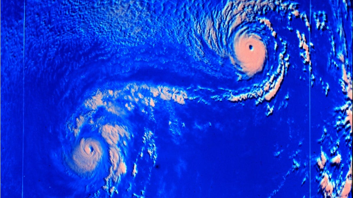
The Fujiwhara effect is a fascinating phenomenon in meteorology where two storms rotate around one another. While it’s most commonly observed with tropical cyclones like hurricanes and typhoons, it can occur in other weather systems as well.
According to forecast experts, the impending Hurricane Helene could interact with another storm system referred to as a trough of low pressure in the south-central U.S. This interaction could lead to widespread flooding in areas across multiple states that are far away from the hurricane’s main location.
As Helene travels from Florida into the Southeast, meteorological models indicate that it may undergo a Fujiwhara interaction with a low-pressure system over the Ozarks, as mentioned by the National Weather Service in Shreveport, Louisiana, in a forecast discussion released on Monday.
“This means that the remnants of the hurricane making landfall will get close to the larger trough over the Ozarks, swirling around it before ultimately merging to create a larger closed trough,” the weather service explained.
“This occurrence is extremely rare in this area!,” shared KATV meteorologist James Bryant on social media.
Potential for Heavy Rain and Flooding
Forecasters predict that the interaction of these systems will bring significant, possibly flooding, rain to parts of the Mid-South and Ohio Valley over the coming days.
“From the Florida Gulf Coast to the Tennessee Valley and southern Appalachians, heavy to excessive rain is expected,” stated the weather service in Little Rock, Arkansas. “Certain regions might see over six inches of rainfall. In northern Arkansas, expected rainfall ranges from two to three inches or more.”
Understanding the Fujiwhara Effect
The Fujiwhara effect occurs when two hurricanes are rotating in the same direction and are close enough to each other that they start to orbit around a common center, according to the National Weather Service.
This meteorological effect typically takes place when the storms are about 900 miles apart.
When two storms experience the Fujiwhara effect, they seem to be rotating like dance partners rather than spinning around each other directly. They move about a central point between them, like two dancers holding hands and twirling together in a circle.
To visualize this, imagine two speeding ice skaters moving toward each other, nearly colliding, who grab hands at the last second and start spinning around a central point together.
The term “Fujiwhara effect” is named after Dr. Sakuhei Fujiwhara, who led the Central Meteorological Bureau in Tokyo, Japan, shortly after World War I. In 1921, he published a study on the movements of “vortices” in water, which are whirl-like motions seen in things like whirlpools.

