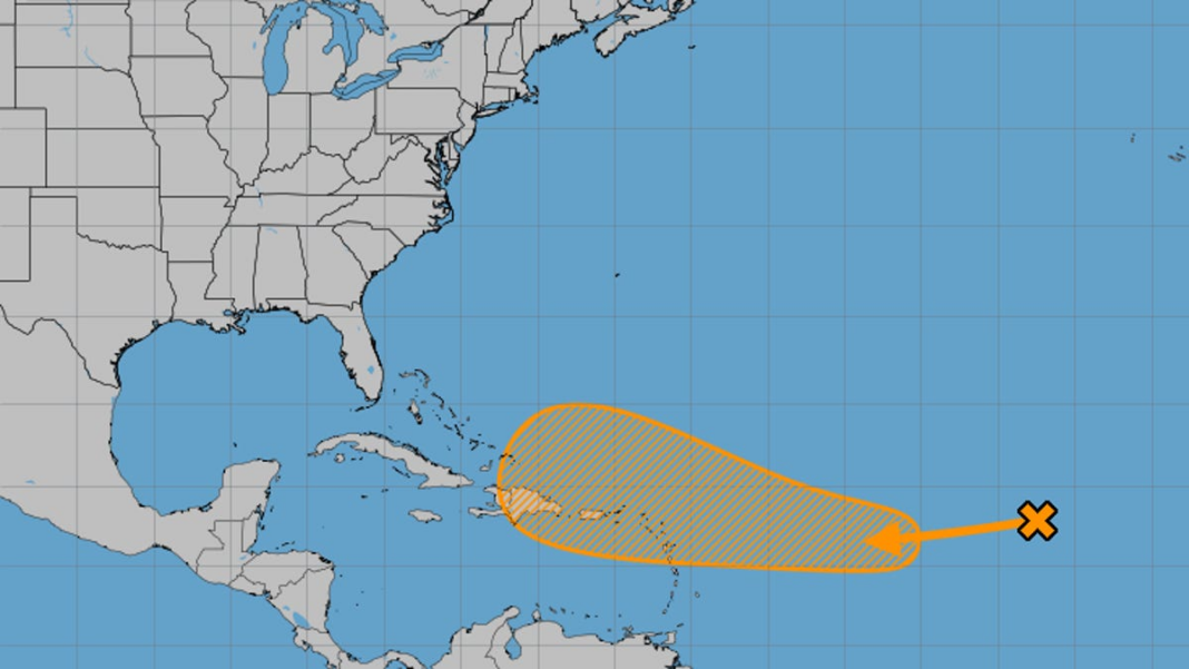
Storm tracker: National Hurricane Center is observing ‘area of active weather’ in the Atlantic
The hurricane season spans from June 1 through November 30, with peak activity generally occurring from August to October.
Just under a week after Hurricane Milton struck Florida, weather experts have indicated that another tropical depression may develop in the Atlantic by the end of this week, as stated on Monday.
The National Hurricane Center (NHC) based in Miami is monitoring a “zone of active weather” located west of the Cabo Verde Islands in the Atlantic, which has a 60% chance of developing over the next week.
According to Anthony Reynes, a senior forecaster with the National Weather Service in Miami, the NHC is “keeping an eye” on the low-pressure area named AL94.
Reynes described this system as a “potential storm.”
As the system progresses westward, the combination of warmer ocean waters and favorable environmental conditions may enhance the possibility of it becoming a tropical depression.
AL94 has a 10% chance of developing within the next 48 hours, while its chances increase to 60% in the upcoming week, according to the NHC.
What is the trajectory of AL94?
Forecasts suggest that AL94 will move in a west or west-southwest direction in the coming days. Mid to late this week might present more favorable conditions for its gradual development, according to the NHC.
A tropical depression might take shape as AL94 continues its west-northwestward path, approaching the Leeward Islands, which are located around 350 miles southeast of Puerto Rico by the week’s end.
Meteorologists are also observing a system in the Caribbean
Weather experts are additionally monitoring a different area for possible tropical development: According to AccuWeather meteorologists, there is a medium chance of tropical activity in the western Caribbean from October 17-19.
The area of interest appeared on the hurricane center’s forecast map on Monday afternoon: “A broad region of low pressure is predicted to develop over the southwestern Caribbean Sea by the middle to late this week,” stated the hurricane center, indicating a 20% chance of development in the next seven days.
Regarding the potential path of the Caribbean storm, “one scenario might lead the system west towards Central America and southern Mexico, while another could see it unfortunately moving towards Florida,” noted AccuWeather hurricane expert Alex DaSilva.
(This story has been updated with the latest information.)

