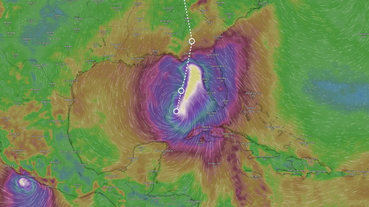
Hurricane Helene projected to strengthen to Category 4 as it approaches Florida
Hurricane Helene is now anticipated to escalate into a major Category 4 hurricane, boasting winds of 130 mph as it rapidly heads toward Florida, with landfall expected on Thursday.
Initially, Helene was expected to be a Category 3 storm, but it is intensifying as it nears the coast.
The National Hurricane Center has warned that “a catastrophic and life-threatening storm surge is probable in parts of the Florida Big Bend shoreline, where flooding could reach up to 20 feet above ground, accompanied by damaging waves.”
According to forecasters, the Florida Panhandle and Big Bend areas between Tallahassee and Gainesville “must brace for hurricane effects,” as stated by AccuWeather’s lead hurricane expert Alex DaSilva in an interview with YSL News.
AccuWeather’s Chief Meteorologist Jon Porter stated, “This could be the storm that defines the 2024 hurricane season.”
Helene is set to make landfall in the eastern section of the Florida Panhandle—likely in the Big Bend region, which forms a curve in the peninsula towards the Gulf of Mexico—late Thursday, according to forecasters from AccuWeather.
Governor Ron DeSantis declared a state of emergency on Monday afternoon for 41 out of Florida’s 67 counties along and near the Gulf Coast, covering the entire Panhandle area.
Helene is forecasted to produce rainfall between 8 and 12 inches, with isolated regions potentially receiving up to 2 feet.
As of its current path, Helene is expected to unleash severe conditions across Florida and the Gulf Coast, along with heavy rainfall extending to Georgia and the southern Appalachian regions, YSL News reported.
Helene is the fourth hurricane to impact the U.S. in 2024
With Helene, there have been four hurricanes hitting the mainland U.S. in 2024:
- Beryl: Category 1, Matagorda, Texas, July 8
- Debby: Category 1, Florida’s Big Bend area, Aug. 5
- Francine: Category 2, Morgan City, Louisiana, Sept. 11
Which advisories are currently active?
- Storm Surge Watch: From Indian Pass south to Bonita Beach, Florida, including Tampa Bay and Charlotte Harbor.
A Storm Surge Watch indicates the potential for life-threatening inundation from rising water moving inland from the coast within the next 48 hours.
- Hurricane Watch: Gulf Coast of Florida from Englewood moving north and west towards Indian Pass, including Tampa Bay.
A Hurricane Watch signifies that hurricane conditions are possible in the monitored region, typically issued 48 hours prior to the onset of tropical-storm-force winds.
- Tropical Storm Watch: Gulf Coast of Florida from Indian Pass to the Walton/Bay County line, and from north of Bonita Beach to south of Englewood.
A Tropical Storm Watch indicates that sustained winds of 39 to 73 mph might occur within 48 hours with a tropical, subtropical, or post-tropical cyclone.
This article has been updated with the latest information.

