‘Homegrown’ storm off Carolinas may bring 20 inches of rain
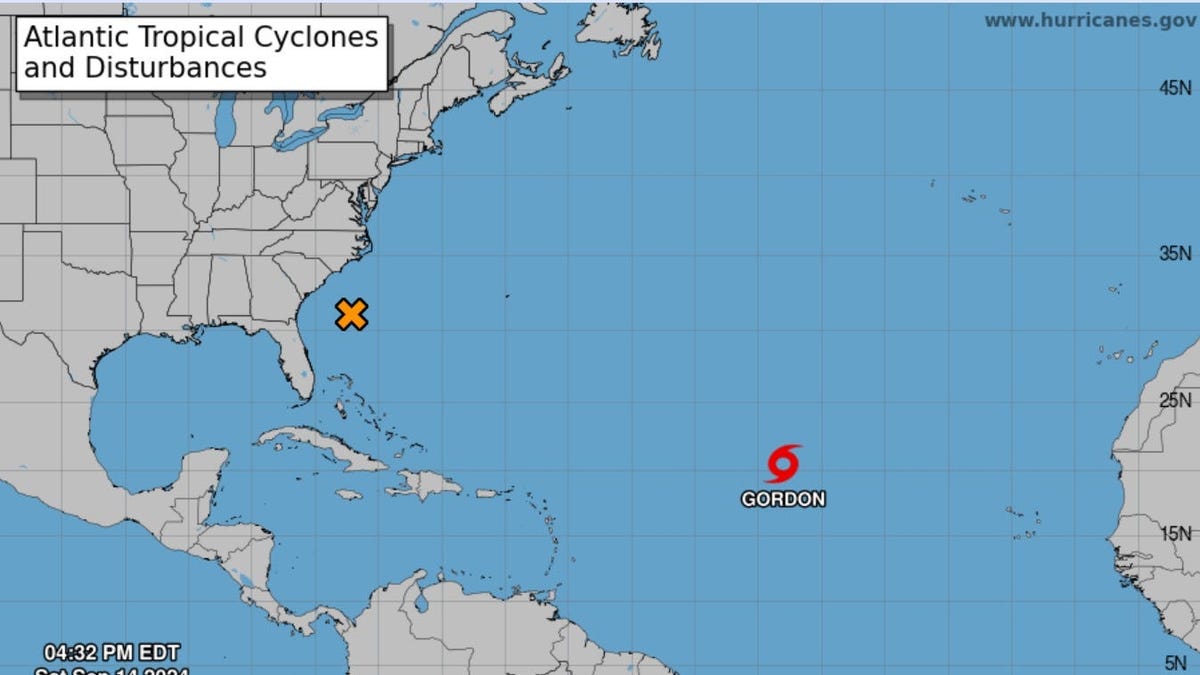
A developing storm near the coast of the Carolinas is expected to gain strength and could reach tropical storm levels as it gradually approaches land, potentially causing several days of strong winds, heavy rainfall, and flooding, according to forecasts released Sunday.
The National Weather Service in Morehead City, North Carolina indicated that the situation remains unpredictable due to the storm’s fast-changing nature.
“We’re closely watching the low pressure system forming off the Southeast Coast,” the weather service tweeted on Sunday. “Conditions will start to worsen today with strong winds, hazardous marine conditions, minor flooding along the coast, and strong rip currents.”
AccuWeather predicts that heavy rain could begin impacting parts of North Carolina, South Carolina, and Virginia as soon as Sunday night. Over the coming days, rainfall totals in many areas may reach 4-8 inches, with some locations potentially experiencing up to 20 inches. Coastal flooding, rip currents, and erosion along beaches may affect regions from northeastern Florida to Delaware, as per AccuWeather’s report.
Other updates:
∎ Ileana has weakened to a tropical depression as of Sunday, following its landfall in Mexico as a tropical storm near Cabo San Lucas. Continued weakening is anticipated, with Ileana expected to become a “remnant low” by the end of the day.
∎ Tropical Storm Gordon has been losing strength in the Atlantic, and it is predicted to downgrade to a tropical depression later today. The National Weather Service confirmed that Gordon poses no threat to land.
∎ In Louisiana, over 16,000 homes and businesses are still without power, four days after Hurricane Francine made landfall as a Category 2 hurricane. Cleanup efforts are ongoing across several states.
Storm may hit the Carolinas on Monday
The weather system off the Carolinas might develop into a tropical storm within the next couple of days, producing wind gusts of up to 80 mph, which may lead to power outages, AccuWeather has warned, indicating that landfall could occur along the North Carolina coast near the South Carolina border late Monday.
“Certain access routes to the barrier islands might be obstructed by high waters or damaged due to erosion,” noted AccuWeather senior meteorologist Alex Sosnowski. “Properties along the beach could be at risk.”
‘Homegrown’ storm making its way to shore
The storm will be classified as a tropical depression if it can establish a defined center and the winds start moving in a circular pattern. It will be termed a tropical storm and receive a name if the sustained winds reach 39 mph.
AccuWeather describes this storm as a relatively unusual “homegrown development,” as most tropical systems during hurricane season typically form thousands of miles to the south in the central Atlantic and then move westward toward the shore.

