
California snow warning for Sierra Nevada is the earliest in two decades
Travelers in the Sierra Nevada should consider alternative routes due to potential road closures, as per the National Weather Service.
California has issued its earliest snow warning in 20 years, particularly for residents living in the Sierra Nevada, according to the National Weather Service.
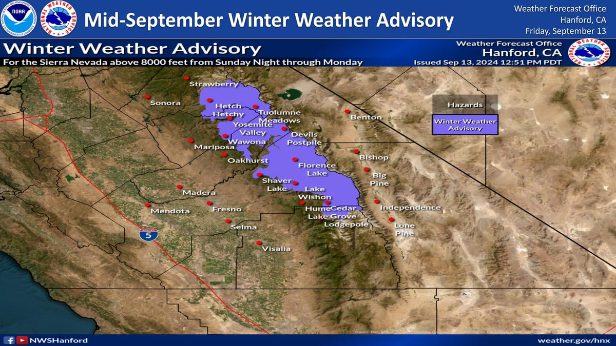
From Sunday evening to Monday, regions in the Sierra Nevada above 8,000 feet are expected to receive snowfall, with probabilities ranging from 35% to 65% for accumulating 2 inches or more.
“A very cold air mass is entering the region this afternoon and will pass through by Monday,” said JP Kalb, a meteorologist with the weather service, to YSL News.
This weather pattern will also bring rain to the San Joaquin Valley.
The winter weather advisory will be in effect from 11 p.m. local time on Sunday night until 5 p.m. on Monday.
Hazardous Road Conditions
State Road 120, which goes through Tioga Pass near Yosemite National Park, is likely to receive more snow than other locations, according to the weather service. It’s one of the key roads to access the park.
There’s a 40% chance of accumulating 3 inches or more of snow.
Located 231 miles east of San Francisco, Tioga Pass stands at an elevation of 9,943 feet and is typically closed in winter due to heavy snowfall.
Travelers to Yosemite National Park may also encounter snowy conditions.
Those driving through the Sierra Nevada this week should have backup plans due to possible road closures. Drivers in the Valley should be cautious of slippery roads.
The decision regarding the closure of SR 120 will be made by Yosemite National Park officials, according to David Spector, a meteorologist with the weather service.
Another Potential for Snow Later in the Week
There is an additional 40% chance for Tioga Pass to receive 3 inches or more of snow from Wednesday to Thursday as another low-pressure system approaches the area.
California Wildfires Unaffected
While multiple wildfires are currently burning in Southern California, the predicted rain will not lessen their impact.
“The majority of the wildfires are located well south of the advisory area,” Kalb noted.
Forecasts suggest that precipitation levels will be 33% to 40% lower than average. Last year also saw slightly below-average precipitation.
Despite this unusually early snow advisory, the weather service warns that the drought affecting the Missouri River Basin, impacting parts of Northern and Southern California, may intensify through September.
Julia is a trending reporter for YSL News. Connect with her on LinkedIn, and follow her on X, formerly Twitter, Instagram, and TikTok: @juliamariegz