Major Storms Expected to Bring Heavy Snow and Rain to the Northwest This Week
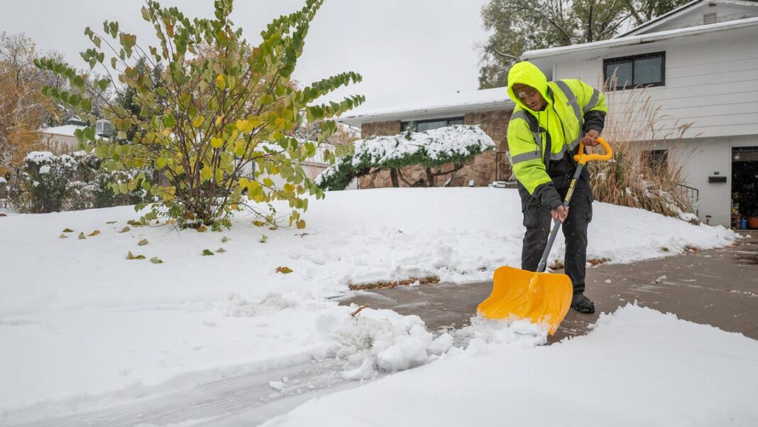
This week, two successive storms are projected to bring significant snowfall and rainfall to parts of the Pacific Northwest, northern California, and the Rockies, prompting winter storm and flood alerts.
The incoming storms from the Pacific are attributed to an atmospheric river, which is a stream of moist air that occurs when warm tropical air moves toward colder regions.
According to the National Weather Service, the first storm will reach land on Monday, leading to heavy rainfall along the coast and snowfall in the mountainous areas of the Pacific Northwest and northern California. By Monday evening and into Tuesday, this wintry weather is expected to extend into the northern Rockies and Great Basin, potentially delivering 8 to 12 inches of snow to the Cascades.
The following storm is anticipated to arrive in the Pacific Northwest on Tuesday night, bringing rain and thunderstorms to coastal regions and parts of the Coastal Ranges, where flooding could occur. This storm will also likely contribute additional snowfall to the Cascades as it progresses eastward.
“Rainfall totals may reach up to 3-4 inches in the Olympic Mountains and 1-2 inches in Seattle and Portland,” said Elizabeth Danco, a meteorologist at AccuWeather.
The Seattle office of the National Weather Service has issued warnings regarding the potential for river flooding this week.
“There will be minimal breaks between each storm system, leading to several rivers likely reaching Action Stage with minor flooding expected, especially by Wednesday or Thursday,” the forecast noted. “The severity of the flooding will depend on rainfall rates, temperatures, snow levels, and total precipitation from each storm next week.”
Winter storm warnings are already in effect for several Western states as of early Monday. In central Oregon, officials have warned residents to be cautious, anticipating snow accumulation between 8 to 16 inches, along with wind gusts up to 50 mph.
“Travel could become extremely challenging. Hazardous conditions may affect the Monday morning and evening commute, and gusty winds could snap tree branches,” reported the weather service in Medford, Oregon, in a winter weather advisory that may be extended into Tuesday. Similar alerts have been issued across parts of Washington, northern California, Utah, and Nevada.
In the northern hemisphere, atmospheric rivers typically occur during winter and are often linked to intense storms in the West. NASA states that they serve as the largest transport mechanisms for freshwater on the planet.
Storms Follow Record-Breaking Snowfall in Las Vegas and Other Regions
The approaching storms to the northern West Coast come as some regions are still recovering from record levels of snowfall.
In Colorado, Lincoln and Elbert counties experienced historic snowfall ranging from 35.5 inches to 41.5 inches between Tuesday and Saturday.
Colfax County in New Mexico was covered in 40 inches of snow at higher elevations between Wednesday and Friday, while parts of Albuquerque saw 7.5 inches of snow.
Las Vegas, Nevada, recorded over 30 inches of snow last week, breaking a long-standing record, which led to road closures and power outages.
Rain Expected in Eastern States Amid Ongoing Wildfires
Meteorologists forecast rain and thunderstorms across much of the eastern U.S. this week, from New England to the Gulf Coast, though it likely won’t be sufficient to mitigate the wildfire threat continuing in the Mid-Atlantic region.
Ahead of a cold front on Monday, heavy rain is predicted for the Carolinas and the central Gulf Coast. A secondary front may also bring rain throughout the interior Northeast, including Upstate New York and New England.
The storms follow showers that reached the Atlantic coast Monday morning, after bringing 0.17 inches of rainfall to New York City, marking the highest amount of rain in the metropolitan area since late September. Over the weekend, wildfires caused hazy conditions and air quality alerts in the most populated city in the nation.
The Mid-Atlantic region is facing an unprecedented dry period. According to the National Weather Service, New Jersey and Delaware experienced their driest October ever. Additionally, Trenton, New Jersey just set a new record for the longest stretch of days without rainfall since 1903.
Brett Anderson, a senior meteorologist with AccuWeather, commented, “While this rain isn’t sufficient to alleviate the ongoing drought, it will dampen the surface soil and vegetation. This may help in reducing dust storms caused by wind and may also minimize the risk of wildfires igniting and spreading on Monday as wind conditions change.”

